

Big Picture Atlas: Emily Bone


2 рецензии
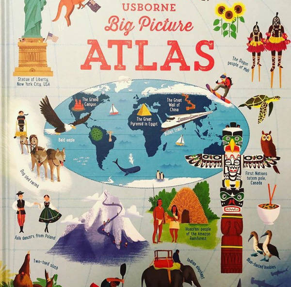
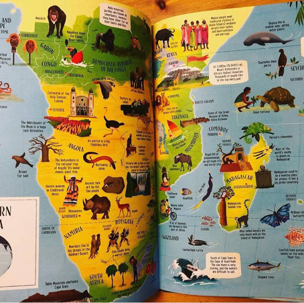
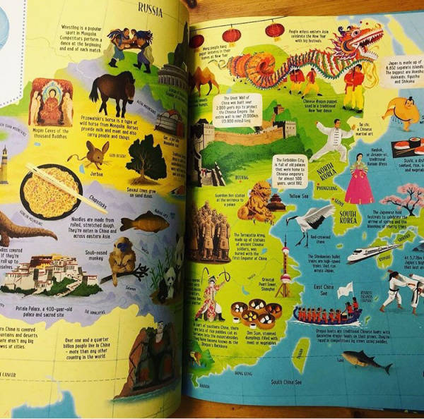
Filled with illustrations and an abundance of interesting facts, this is an atlas with a pictorial difference. Children can learn where countries are located, identify what they look like while discovering more about the world they live in. Explore this busy and exciting picture atlas to discover fa
Полная аннотация
Автор
Издательство
Все характеристики
Аннотация
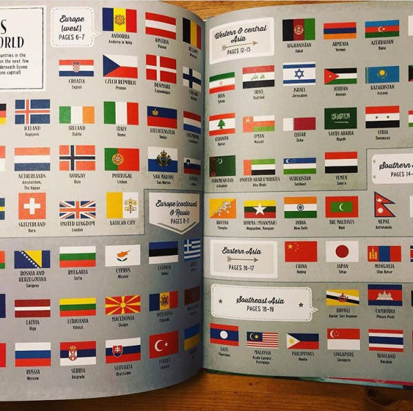
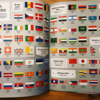
Filled with illustrations and an abundance of interesting facts, this is an atlas with a pictorial difference. Children can learn where countries are located, identify what they look like while discovering more about the world they live in. Explore this busy and exciting picture atlas to discover fascinating facts about the world. Find out how cold a Siberian winter is, how many different tribes live in the Amazon rainforest, and which country has endured the biggest ocean wave in the world. An excellent book to develop a child's geographical knowledge, sparking an interest in history and landmarks across the globe. Includes a double-page map of the world and a list of every country's flag and capital city.
Характеристики
ID товара
724845
ISBN
9781409598701
Язык
Английский
Страниц
40 (Офсет)
Вес
802 г
Размеры
362x286x11 мм
Тип обложки
7Б - твердая (плотная бумага или картон)
Иллюстрации
Цветные
Все характеристики
Нет в продаже
Рецензии на книгу
Читали книгу? Как она вам?
Мы всегда рады честным, конструктивным рецензиям.
Покупатели 1
Эксперты 1
Екатерина Исаева
21 января 2020 в 21:18


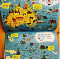
Замечательный атлас мира от одного из лучших изданий книг на английском языке! Формат А3, 7 континентов,множество деталей:жители флоры и фауны,местное население,исторические факты и даже особенности местной кухни!!!Большой формат ,красивая книга,которая несомненно пригодится и для обучения в школе и для саморазвития!!...
Понравилась рецензия?
Да
Книги из жанра


1 0932 733 -60% Еще 3 дня


8302 076 -60% Еще 3 дня
